Ngari Grand Circuit: 14 Days on Tibet's Wildest Road

This is not a guide. It is what happened when my wife and I spent two weeks driving a rented Jeep across western Tibet in July 2025: 14 days, 4,100 kilometers, and a route that took us from Lhasa to Everest, past Mount Kailash, through a lost kingdom, across one of the emptiest regions on Earth, and back again.
Why write this down? Because the Ngari Grand Circuit exists in a strange gap. Chinese travelers know it. International travelers mostly do not. The handful of English-language accounts I found before our trip were either package-tour recaps with no practical detail, or professional photo expeditions with budgets and support crews we did not have.
We did it ourselves, made mistakes, figured things out, and came back with a story worth telling.
Day 1-2: getting there
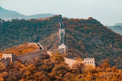
Huaihua to Chongqing by overnight train. Chongqing to Lhasa by air the next morning. Two plane tickets cost ¥2,460. The flight from Chongqing to Lhasa takes a little over two hours, but the transition is disorienting: sea-level humidity to 3,650 meters of dry高原 air in the time it takes to eat a mediocre airplane meal.
[IMAGE: Lhasa first view from the airport bus, Potala Palace in the distance]
The airport bus costs ¥30 per person and takes 70 minutes to reach the city. We checked into the Snow Lotus Oxygen Hotel near Jokhang Temple, a Tibetan-style courtyard building with modern rooms and, more importantly, piped oxygen. The first night in Lhasa, you notice the altitude in small ways: a flight of stairs leaves you breathing harder than it should, and you wake up at 3am with a dry throat and a mild headache that does not quite qualify as pain but keeps you from falling back asleep.
We spent the next day doing nothing useful: walking the Barkhor circuit, drinking yak-butter tea, sitting on benches and watching pilgrims. This is the correct Lhasa itinerary for day one. The altitude will punish ambition.
Day 3: acclimatization, and the oxygen question
If you take one piece of practical advice from this diary, make it this: rent a portable medical-grade oxygen concentrator in Lhasa before you leave.
[IMAGE: Oxygen setup in the Jeep, concentrator unit and steel cylinder secured in the back]
We rented a YDD-5B concentrator that plugged into the car’s 12V outlet and ran continuously while we drove. It was not cheap, and it was the single best decision of the entire trip. At 5,000 meters, when you feel your pulse in your temples and every movement costs more than it should, ten minutes on concentrated oxygen returns you to something like normal. I watched my blood oxygen climb from 78% to 94% on the pulse oximeter. The numbers do not lie.
Lhasa has at least four oxygen supply companies. We used one near the Yihai car rental office. A 10-liter steel cylinder costs ¥50 to fill, ¥20 per day to rent, and holds about eight hours of continuous flow. We also carried a refillable 15L cylinder as backup. Bring rope, bungee cords, or old prayer scarves to tie the cylinders down. On unpaved roads, an unsecured oxygen tank becomes a missile inside your car.
Hotels above 4,000 meters almost all offer in-room oxygen now: either a concentrator unit or piped oxygen through a wall outlet. Use it. Sleeping with oxygen makes the difference between waking up functional and waking up with a splitting headache at 4am.
Day 4: Lhasa to Lhatse — the road begins
We picked up the Jeep from Yihai (a Tank 300, ¥348 per day) and headed west on the G318. First stop: Zhashilhunbo Monastery in Shigatse, a sprawling complex of golden roofs and whitewashed walls that rivals the Potala in scale if not in fame. The main hall holds a 26-meter seated Buddha statue, the largest indoor bronze Buddha in the world. You walk in, look up, and the face of the statue fills your entire field of vision.
[IMAGE: Zhashilhunbo Monastery, golden roof against blue sky]
Past Shigatse, the landscape begins to empty out. The G318 climbs toward the 5,000-meter mark. At the G318 5,000km monument near Lhatse, we stopped for the obligatory photo. The monument is a stone pillar by the side of the road with prayer flags flapping in wind that never quite stops. Beyond it: brown hills, blue sky, and a highway that stretches west into the Tibetan plateau with nothing on either side.
We stayed at the Yunshuiji Future Hotel in Lhatse (¥389, free oxygen concentrator in the room, massage chair, heated toilet seat). Lhatse sits at 4,020 meters. At this altitude, a heated toilet seat is not a luxury. It is a small act of mercy.
Day 5: Everest
The day started in Lhatse and climbed to Gyatso La Pass (5,248m), where five 8,000-meter peaks line up on the horizon on a clear day: Everest, Lhotse, Makalu, Cho Oyu, and Shishapangma. The pass is a riot of prayer flags. The wind rips through them at 40 kilometers an hour. If you stand still for more than a minute, your fingers go numb and your lips chap. It is spectacular and deeply uncomfortable in equal measure.
[IMAGE: Gyatso La Pass, prayer flags with snow peaks in the background]
Then comes the road to Everest Base Camp: 108 hairpin turns climbing 800 vertical meters in 50 kilometers. The turns are numbered. We counted. By turn 60, my wife was carsick. By turn 100, she was asleep, which is the body’s way of opting out.
At Gawula Pass (5,210m), the full panorama of the high Himalayas opens up. You park, walk to the viewing platform, and stand there staring at a wall of snow and rock that stretches across the entire southern horizon. Five peaks above 8,000 meters, lined up like they were arranged for a photograph. The wind at the pass is strong enough to lean into. People stand on the roofs of their Land Cruisers taking photos that will never capture what it actually feels like to be there.
[IMAGE: Panorama from Gawula Pass, five 8,000m peaks on the horizon]
From the park gate, you switch to an electric shuttle bus (¥120 per person). Private cars are no longer allowed the last 50 kilometers to base camp. The bus drops you at a cluster of buildings at 5,200 meters: a row of tent hotels, a small post office, a monument with the elevation carved into it, and in front of you, filling the entire southern sky, the north face of Everest.
It is not pretty in the way mountains in Switzerland are pretty. It is a black pyramid of rock with a plume of snow blowing off the summit. It is indifferent to your presence. It has been there for 60 million years and it will be there when your grandchildren are dead. That is the thing that gets you: the scale. Not the height — you knew the number before you came — but the mass of it. The weight. The way it makes everything else in your field of vision look like an afterthought.
We stayed at the Rongbuk Guesthouse (¥686, facing Everest). Not a tent, an actual building with walls and heating. At 8pm, the evening light turned the summit gold for about twelve minutes. Everyone stood outside in the cold taking the same photo. Twelve minutes later, the light was gone, the temperature dropped ten degrees, and we all went inside.
Someone had brought a Bluetooth speaker to the open area near the monument. By 9pm, a group of young Chinese travelers had started what can only be described as a high-altitude dance party at the foot of Everest. At 5,200 meters. While on supplemental oxygen. I watched a man in an inflatable dinosaur costume do the macarena next to the elevation monument. This is not the Everest experience the mountaineering books describe, but it is the Everest experience that actually exists in 2025, and honestly, it was great.
Day 6: Everest to Saga — Pekutso and Shishapangma
The road out of base camp retraces the 108 turns in the opposite direction. We stopped at the abandoned Guandi Temple in Old Tingri, a Qing-dynasty shrine to the Chinese god of war built in 1794 by soldiers who had just defeated a Gurkha invasion. From the temple’s perch at 4,398 meters, you can see Everest on a clear day. The connection between a Chinese war god and a Tibetan mountain is historically accidental — the temple was built because the soldiers were here, not because the location was sacred — but the juxtaposition is strange and memorable.
[IMAGE: Guandi Temple in Old Tingri with Everest visible on the horizon]
The real reward of this day was Pekutso, a 300-square-kilometer lake at 4,590 meters that reflects Shishapangma (8,027m, the only 8,000-meter peak entirely within China) like a mirror when the wind is down. We arrived at midday. The wind was not down. The lake surface was chopped into a thousand small waves, each reflecting a fragment of the mountain. The effect was not the classic mirror shot you see in guidebook covers. It was better: a shattered mosaic of blue water and white snow, constantly shifting.
At Lhapuk Village on the eastern shore, there is a viewing platform where the lake, the mountain, and a Tibetan village all line up in one frame. We pulled over, ate crackers, and watched a herd of wild donkeys pick their way along the far shore. Nobody else was there.
[IMAGE: Pekutso with Shishapangma reflected in the water]
We slept in Saga (4,600m) at the Yunshuiji Future Hotel (¥682). The hotel had a massage chair and a heated floor. At 4,600 meters, a heated floor is worth every yuan.
Day 7: to Kailash
The landscape between Saga and Tarchen is the Tibet of wall calendars: wide valleys, sand dunes, braided rivers, and the occasional cluster of black yak-wool tents with smoke rising from the center pole. At Zhongba, the G219 passes through a stretch of colorful sand dunes — red, yellow, gray, and white sands eroded from the surrounding mountains — that look entirely out of place at 4,700 meters. Then the Paryang grasslands open up, an ocean of pale green dotted with sheep and the occasional Tibetan wild ass.
[IMAGE: Colorful sand dunes near Zhongba on the G219 highway]
Late afternoon, we crossed the “Hidden Western Tibet, Heavenly Ali” archway that marks the border between Shigatse Prefecture and Ngari. And then, around a bend in the road, Mount Kailash appeared.
Kailash does not look like the mountains around it. It is a black pyramid with a cap of permanent snow, standing alone on the horizon. At 6,656 meters, it is not the tallest peak in the region. But its symmetry — four distinct faces aligned roughly with the cardinal directions — makes it look less like a mountain and more like something that was placed there intentionally.
No one has ever summited Kailash. The Chinese government banned climbing in the early 2000s out of respect for its religious significance. Four religions — Tibetan Buddhism, Hinduism, Bon, and Jainism — consider it the center of the universe. Tibetan Buddhists call it Gang Rinpoche, “precious jewel of snow.” Hindus believe it is the throne of Shiva. The Bon faith, which predates Buddhism in Tibet by centuries, holds that it is the sacred nine-story mountain where their founder descended from heaven.
[IMAGE: Mount Kailash, black pyramid with snow cap, seen from the G219 highway]
The circumambulation route takes three days on foot. We did not walk it — the altitude, the time, the physical preparation required. We drove to a viewpoint near Tarchen, sat on the hood of the Jeep, and watched the evening light move across the mountain’s south face. At sunset, the summit turned pale gold for about eight minutes. A Tibetan family parked next to us was prostrating toward the mountain. The old woman’s forehead touched the ground, rose, touched again. She had probably been doing this for hours.
We stayed at the Castle Hotel in Tarchen (¥451, no breakfast, large courtyard, in-room oxygen). Tarchen is a small strip of guesthouses, Sichuan restaurants, and supply shops at 4,651 meters. It exists entirely to serve pilgrims and the occasional Ngari road-tripper. The Sichuan restaurant we ate at had a menu with photos and a cook who came out to confirm we wanted “not spicy” after seeing our faces.
Day 7 bonus: the two lakes
Just south of Kailash, separated by a narrow strip of land, two lakes sit side by side. Manasarovar is the sacred one: 412 square kilometers of the clearest freshwater in Tibet, sacred to Buddhists and Hindus. On a calm day, its surface is a slab of turquoise that mirrors Kailash perfectly. We walked to the shore near Jiwu Temple. The water was cold enough to ache, impossibly clear. A few Indian pilgrims were collecting water in plastic bottles to take home. To Hindus, Manasarovar was created in the mind of Brahma. A single circuit of the lake on foot takes four to five days.
[IMAGE: Manasarovar, turquoise water with Kailash reflected in the distance]
Rakshas Tal, the “demon lake,” sits right next to it: smaller, saltier, darker, ringed by bare red hills. The two lakes used to be one body of water before geological uplift separated them. Tibetan legend says they represent the duality of good and evil. The practical difference: Manasarovar is full of life, Rakshas Tal is mostly dead. On a windy afternoon, Rakshas Tal churns up waves from nowhere. The contrast is uncomfortable in a way that feels deliberate — as if the landscape itself is making a theological point.
[IMAGE: Rakshas Tal, dark water against red hills, wind-chopped surface]
Day 8: the lost kingdom
If you only have one day in western Tibet to go somewhere most travelers skip, make it the road from Tarchen to Zanda.
This was the richest single day of the trip. We left the G219 and took a network of small roads through a series of sites that trace the arc of a vanished civilization: the Bon temple at Zhida Buri, the cliff-face monastery of Guru Jiang, the ruins of Qiongloin Silver City (the ancient capital of the Zhangzhung kingdom, built on a mountain at 4,400 meters), the Dongpo Temple site, the Daba fortress ruins.
[IMAGE: Qiongloin Silver City, ancient stone ruins on a mountain ridge]
Then the Zanda clay forest. The road climbs to the Malam Canyon viewing platform, and suddenly the entire world below you dissolves into a maze of eroded clay pillars, ridges, and gullies stretching to the horizon. It looks like a dried ocean floor sculpted by a million years of wind. Photographs fail here. The scale is too big, the light too flat without the low-angle sun of late afternoon.
[IMAGE: Zanda clay forest panorama from Malam viewing platform]
The Guge Kingdom ruins sit on a steep hill above the Sutlej River canyon. From the 10th to the 17th century, this was a regional power, a Buddhist kingdom that controlled trade routes between India and Tibet. Then, in the 1630s, it collapsed. No one is entirely sure why. The Portuguese Jesuit Antonio de Andrade visited in 1624 and wrote a detailed account of the kingdom. By 1635, it was gone.
What remains: a pyramid of cave dwellings, temples, and palace chambers carved into a brown hill. The Red Hall and White Hall still hold murals — Buddhist iconography with visible Kashmiri influence, painted with ground lapis lazuli and malachite. You climb the steep paths between levels, duck through doorways carved into the rock, and emerge on a rooftop with a view of the entire canyon. At sunset, the ruins turn the color of rust, then copper, then shadow.
[IMAGE: Guge Kingdom ruins, the pyramid hill at sunset]
We stayed at the Gangdise Hotel in Zanda (¥368, breakfast included). Dinner was mushroom hotpot at a restaurant called Junwang Fu. The mushrooms were fresh. At 3,730 meters in a town of 10,000 people in far western Tibet, fresh mushrooms feel like an unreasonable luxury.
Day 9: crossing the Gangdise
This was the day the trip changed texture. We left Zanda, drove back past Kailash, and turned north onto the dirt track toward Yagra.
[IMAGE: Dirt road leaving the G219 toward Yagra, mountains in the distance]
The paved road ends at a checkpoint 17 kilometers south of Tarchen. A small sign points toward Yagra: unpaved, no cell signal, no services for the next 200 kilometers. The track climbs through the Gangdise mountain range, a landscape of gray scree slopes and the occasional herd of Tibetan wild ass. We kept the speed around 70 km/h — fast enough to float over the washboard, slow enough to not lose control. The Tank 300 handled it well. My wife handled it by gripping the door handle and not speaking for an hour and a half.
Yagra is a dot on the map with a gas station that closes at 4pm and only sells 92-octane fuel. We arrived at 3:45pm. The attendant was closing the shutters. A ¥100 tip persuaded him to stay open for five more minutes. We filled both tanks, added octane booster, and kept moving.
From Yagra to Rendo is another 93 kilometers of gravel track through grazing land. At sunset, we crested a ridge and saw Rendo below us: a cluster of white buildings in a brown valley, ringed by snow peaks. The Rendo Xinyue Inn (¥260) had hot water and electricity. That was enough.
Day 10: the uninhabited zone
The drive from Rendo to Coqen crosses the edge of the Changtang, the northern Tibetan plateau that is one of the least populated places on Earth. Our GPS track showed nothing but contour lines for 255 kilometers. No villages. No gas stations. No cell towers.
[IMAGE: The middle route, gravel track stretching to the horizon, no signs of human life]
The road follows a dry riverbed, then climbs onto a plateau of reddish gravel. We saw Tibetan antelope — small herds of five or six, moving fast across the open ground, their white rumps flashing in the sun. We saw a wolf, a solitary gray shape that loped across the track 200 meters ahead of us and disappeared into a gully. We saw fat marmots standing on their hind legs next to their burrows, watching us pass with what looked like indignation.
Midway through the day, we reached Zabuye Salt Lake. It is twice the size of Qinghai’s famous Chaka Salt Lake and receives almost no visitors because it sits in the middle of nowhere on a route only accessible by off-road-capable vehicles. The lake bed was a crust of white salt crystals stretching to the horizon. We got out, walked onto the salt crust, and stood in complete silence. No wind. No birds. No engine noise. Just salt and sky.
[IMAGE: Zabuye Salt Lake, white salt crust under blue sky]
We reached Coqen at 6pm and checked into the Vienna 3 Best Hotel (¥377, oxygen, heated floors). Dinner at the hotel restaurant: twice-cooked pork, stir-fried cabbage, rice. Basic food tastes extraordinary at 4,660 meters.
Day 11: lakes, lakes, and Wenbu South Village
The middle route through Ngari is called “one lake after another” (一措再措) for good reason. Between Coqen and Wenbu South Village, we passed Zhari Namtso (Tibet’s third-largest lake, 1,023 square kilometers), Muchu Broni (a twin lake connected by a narrow channel), Xuru Tso (blue-green water against snow peaks), and finally Tangra Yumtso.
[IMAGE: Zhari Namtso, vast blue lake from a high vantage point]
Tangra Yumtso is Tibet’s deepest lake, plunging over 210 meters in places. From the eastern shore, the Daro Snow Mountain rises as a wall of black rock and white snow. This is the heartland of the ancient Zhangzhung civilization. Ruins of the middle Zhangzhung kingdom sit on the northeastern shore near Wenbu South Village.
We arrived at Wenbu South Village around 5pm and checked into the Nyima Zhongxiangxiong Cultural Tourism Hotel (¥562, the best hotel in the village, oxygen included, second-floor room facing an open square). At 5pm, the power went out.
For two hours, nothing worked. The hotel staff shrugged and pointed at the power lines. A repair crew was already working somewhere down the road. At 7pm, the lights came back on, and five minutes later, a stage lit up in the square below our window.
[IMAGE: View from the hotel window, stage performance in the square below, dancers in traditional Tibetan dress]
What followed was the single best thing that happened on the entire trip, and we did not plan it. The county cultural bureau had organized a Tibetan song and dance performance. No tickets. No tourist pricing. Just a flat open area, a portable sound system, and two hours of traditional music and dance that the whole village turned out to watch.
There were solo singers whose voices carried across the square without amplification. There were group dances with women in long-sleeved chuba robes, arms linked, moving in slow circles. There were men’s dances with stamping boots and spinning movements that kicked up dust from the square. The costumes were heavy with turquoise and coral, the kind you do not see at staged tourist shows. We sat on our bed, window wide open, watching from the best seat in the house. No crowd, no jostling for position. Just the music rising through the cold evening air and the mountains behind the village turning pink in the last light.
The performance ran from 7pm to 9pm. We ate dinner at a tiny restaurant called Anhui Renjia (¥90 for two) and went to sleep still hearing the drums.
Day 12: Wenbu South to Bangor — the lake parade continues
From Wenbu South, the road runs north past Dangqung Tso, then turns east toward the G317. The star of this section is Serling Tso, Tibet’s largest lake at 2,391 square kilometers. The color is an unnatural cobalt blue that looks like someone turned up the saturation slider in real life. The lake sits at 4,530 meters and is ringed by 23 smaller satellite lakes. Tibetan mythology calls it the “demon lake,” supposedly the home of a demon trapped there by Padmasambhava in the 8th century.
[IMAGE: Serling Tso, intense cobalt blue water against brown hills]
Just south of Serling Tso, at kilometer marker 2442 on the G317, there is a roadside pullout next to a dried riverbed. From the ground, it looks like an eroded gully — unremarkable. But drone footage reveals something startling: the gully fans out into a tree shape, with a trunk, branches, and a crown. The “Sky Tree” of Nyima County. Bring a drone or do not bother. From the ground, it is just a ditch.
[IMAGE: Aerial view of the Sky Tree formation near G317 km 2442]
We slept in Bangor at the Starry Sky Hotel (¥482, oxygen, breakfast). Bangor is a county seat at 4,715 meters. The hotel had a sign in the lobby warning guests not to shower on their first night. At this altitude, a hot shower can trigger altitude sickness by dilating blood vessels and dropping blood pressure. We showered anyway, carefully, and sat on the bed breathing supplemental oxygen for ten minutes afterward. Worth it.
Day 13: Shengxiang Tianmen and the long road back
The final day of driving: Bangor to Shengxiang Tianmen on the north shore of Namtso, then the long highway back to Lhasa.
Shengxiang Tianmen — “Holy Elephant Heaven Gate” — is a natural stone arch on the shore of Namtso, Tibet’s second-largest lake. The arch is about 30 meters tall and 18 meters wide. It looks like an elephant bending down to drink from the lake. The water behind it is a shade of turquoise that photographs make look fake. They are not fake. The lake really is that color.
[IMAGE: Shengxiang Tianmen, the stone elephant arch against Namtso’s turquoise water]
This area was closed to visitors for most of 2023 and early 2024. It reopened in March 2024. You need to book tickets four days in advance through a WeChat mini-program (¥100 including shuttle bus). The road in is harsh: washboard, potholes, and a final stretch of loose gravel that tested the Jeep’s suspension. We bottomed out once. Nothing broke.
From Shengxiang Tianmen, it is 273 kilometers back to Lhasa on the G109. The road passes Yangbajing geothermal field, where steam vents rise from the ground against a backdrop of the Nyenchen Tanglha snow range. We did not stop for the hot springs. We were ready to be done.
We returned the Jeep at Yihai’s Lhasa office, checked into the Lishang Ruixuan Hotel near the return point (¥186, our cheapest room of the trip, and perfectly fine), and ate barbecue at a restaurant called Yueyang Lao San Yang for ¥127. The next morning, we flew home: Lhasa to Chongqing, then high-speed rail to Huaihua.
[IMAGE: Jeep parked at a roadside overlook on the last day, dusty, tired, still running]
What we would do differently
One more day in Zanda. The Guge ruins deserve a full morning and evening, not a rushed afternoon.
Start oxygen earlier. We waited until we felt bad at Everest. Should have started the concentrator at Gyatso La, before symptoms appeared.
Carry more snacks. Between Zhongba and Tarchen, restaurant options are sparse and unpredictable. What you have in the car is what you eat.
Bring a drone. Half the best views on this route — the clay forest, the Sky Tree, the lake colors — only fully reveal themselves from above.
Book Shengxiang Tianmen tickets before departure. The four-day advance booking caught us off guard. We got lucky. You might not.
The total cost for two people, including flights, trains, car rental, gas, hotels, food, and oxygen, came to roughly ¥28,000 ($3,900). That is less per person than most packaged Ngari tours, with complete control over where we stopped and for how long.
Was it hard? Yes. The altitude is relentless, the middle route is genuinely remote, and things go wrong in ways you cannot predict. But I would do it again tomorrow.
For the practical logistics behind this trip — oxygen setup, car rental, gas strategy, hotel list, permits, and what to pack — see the companion guide: Tibet Self-Drive Survival Guide.
New to Tibet travel? Start with our Tibet Travel Guide.